This article is Part Two of ‘Choosing Terrain for Easter 2025″
So what have we found? Easter Friday will be along the remnants of Sandy Creek north of Tarnagulla. The Tappit Hen map is comprised of 25 or so interlinked dredging basins, meaning this is a unique terrain. Tappit Hen – a lidded ale glass obviously so popular with the early miners that they named the largest mine in the area after it.

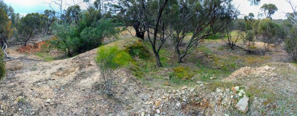
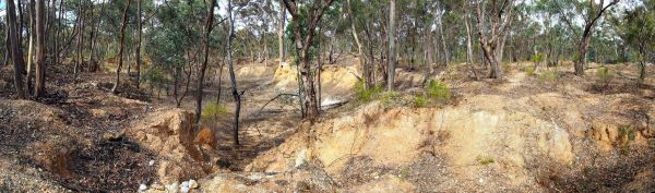
Easter Saturday will be on the outskirts of Inglewood in unusual mallee mining terrain. For decades orienteers have driven along the edge of this map without thinking to explore beyond the dense edge-effect vegetation beside the Calder highway. The Psalm Singing Gully map perhaps has the highest density of reef mining on any Australian map- 900 mapped pits, depressions and mounds in 4 square kilometres of terrain. Combine this with generally limited visibility due to the low mallee canopy and vague contours, and most orienteers will find a challenge awaits them. And the name – it dates from the early mining era and perhaps signifies the presence of Hugenot Protestants who only allowed the singing of Psalms in their worship.
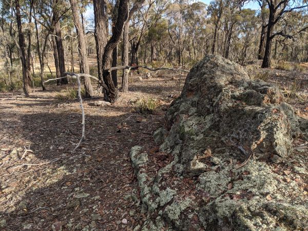
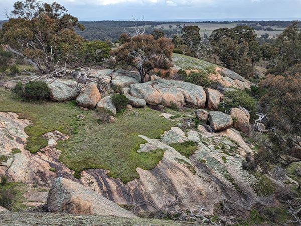
Easter Sunday is planned for a granite area north of Inglewood, named “The Granites”. This was one of the areas identified by Alex Tarr as suitable for a World Championship. More recently, a prominent Victoria orienteer described the terrain as one of the most enjoyable terrains in Australia. That is a big call, but you can make your own judgement.

Easter Monday will be around the township of Tarnagulla – open spur gully with reef mining detail and an arena in a park in the centre of the township.
If you stay around for the following weekend, there may be events on the other three maps. These areas have been relegated to the second weekend not because of inferior quality, but to avoid arena and parking issues that would arise with the larger Easter attendance. One day could be on a remap and extension of the existing Korong Spurs map – a doubling of the terrain area, transforming the map from suitable for just a Middle Distance into also a wonderful Long Distance venue.

Another might be Anderson’s Creek, an area of extensive gravel pit terrain, with some sluicing features, adjacent to fast and open spur gully. In the middle of the map is a cemetery, on some maps named “Boot Hill”.
The third might be on a satellite block of Mt Kooyoora named Wehla Hill. The terrain is open compared to the modern Kooyoora. The Wehla Hill and Andersons Diggings maps were recently used for our season-opening BendiGo ToDay events, proving in each case to be crowd favourites.
There you have it. We believe it is possible to invite Australian orienteers to Loddon Shire to compete in multiple races and not regret the omission of Kooyoora from the program.
See you there.