For most Australian orienteers the town of Inglewood and the surrounding Loddon Shire is synonymous with the granite terrain of the nearby Kooyoora State Park. The park has hosted the World Championships of 1985 and the World Masters Orienteering Championships of 2002, also at Kooyoora. It is arguable that the significance of Kooyoora to our sport blinded us to the potential of the other orienteering terrains in the Loddon Shire.
There was ample evidence that other quality orienteering terrain was available within a moderate distance of Inglewood. Some time after the 1985 WOC Alex Tarr conducted a survey of potential Victorian terrains for a future World Championship. Buried in the report was a short description of two granite areas to the north of Kooyoora that he judged as suitable for a World Short Championship. The idea of hosting another WOC did not have legs. The report languished, sitting in the files of a few orienteers with dreams of new terrain and new maps. The focus solely on Kooyoora was broken when, in 2004, Bendigo Orienteers commissioned Alex Tarr to map Mt Korong, one of the areas Alex had previously identified as World class terrain. Alex mapped the northern side of the mountain and this map was used for a major event in the mid-noughties. In the following decade the Korong Spurs map became the go-to event in the Bendigo Orienteers fixture. The terrain was more open than much of Kooyoora and the technical challenge was just about right for the afficionado of granite orienteering. More excellent terrain was out there, but attention was now focused just a little more widely to include Korong.
Interesting terrain to host a national carnival – without Kooyoora
Around 2010 local Bendigo orienteer Neil Barr found that his employment would require lots of travel across the State to speak with farmer groups. The presentations were generally in the evening and the travel during daylight hours. This presented an opportunity to visit many of the terrains reported by Alex Tarr, as well as quite a few others. This exploration was supplemented by regular Sunday long runs with Julie Flynn in mining terrains identified with gold prospecting guides and historic mining maps.
This systematic exploration has yielded so far six new areas within the Loddon Shire. It was clear there was enough interesting terrain to host a national carnival without revisiting Kooyoora State Park – and importantly without competitors perceiving a missed opportunity to compete on Kooyoora yet again. Two issues stood in the way of such a carnival. The first was lidar availability. Existing lidar was available from government sources for only one of these areas. The Bendigo club was unwilling to invest in a lidar flight given the State government had announced a project to fly lidar for all its public reserves over the next few years. This project had only just commenced when it then ground to a terminal halt due to public health lockdowns.
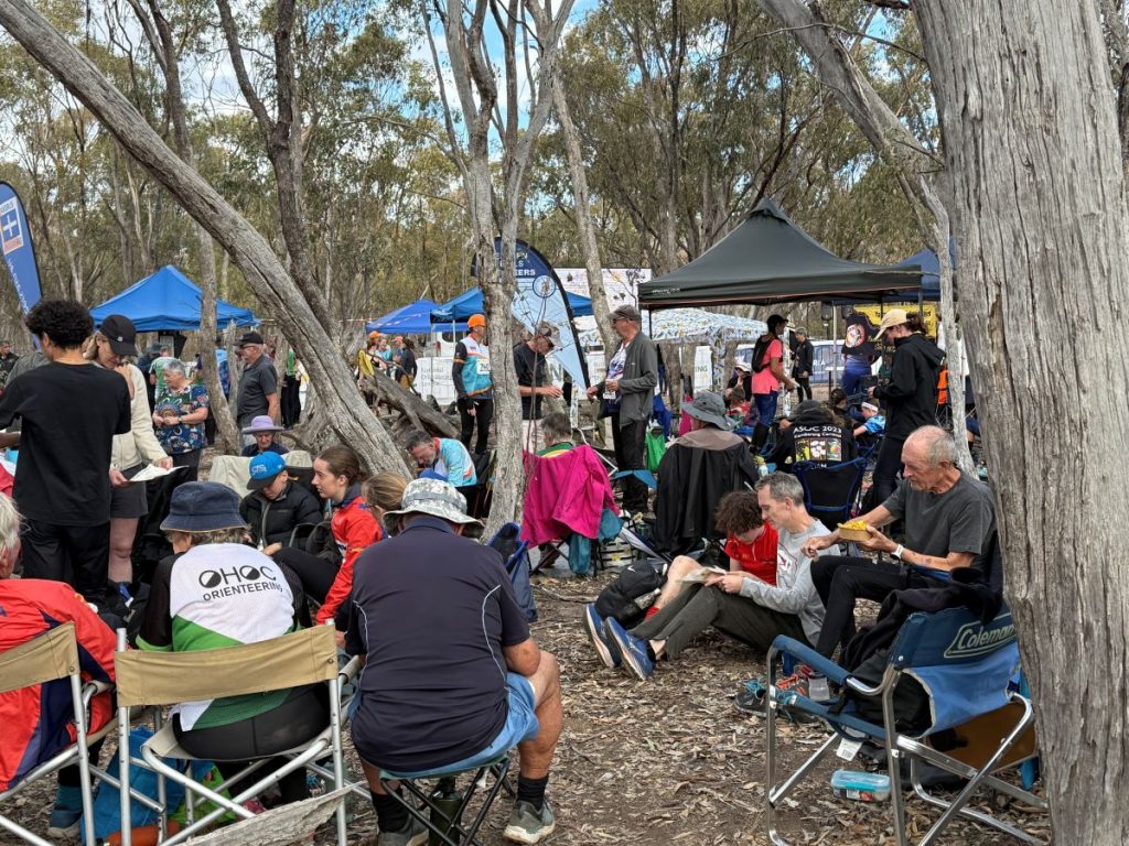
The second issue was accommodation. This came to the fore in the planning for the 2021 (then shifted to 2022) Australian Championships carnival. It is now a requirement to find group accommodation for over 200 participants in the schools entourage. The closest available site was located near Tylden, 75 minutes’ drive from Inglewood and almost 2 hours from the most distant of the potential maps. The terrain search for that carnival became “what can we find near the accommodation”, which is the tail wagging the dog. Clearly the Inglewood terrain would only be used for an Easter carnival. The next on the fixture was 2025.
Mapping the areas
The lidar shortage was overcome by “making do”. For two of the terrains the club had Chris Wilmott photogrammetry commissioned immediately before Chris scrapped his machines. We dusted that off.
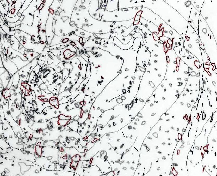
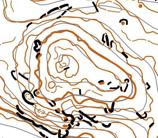
For another map we got our hands on some more analog photogrammetry commissioned by a mining company. There was lidar for one other map. That left two maps where all we had was 10 metre DEM which produced rough contours. We took confidence from the Nuggety Range map used for the 2022 Long Championships which was also mostly based upon a 10 metre DEM… the area being nominated without much attention given to base map availability and with no time to commission lidar. The State had only recently come out of lockdown. The lesson learnt was that mapping with a GPS enabled tablet could transform 10m DEM contours into useable contours, at the cost of more than the usual time to field work.

With an eye to the extra time required for field work, the mapper started work in 2020. Within a few months lockdowns slowed progress. Work was restarted in between lockdowns and continued again after the last ended.
Today, with a year till the carnival, five maps are completed and a sixth is at the 80% mark. The mapping has been slow, with the last map so far requiring 10 weeks FTE of work. Six maps you ask? Well, three are allocated for the carnival and it is anticipated that the other three will be used for the following weekend which includes an ANZAC Day Friday. One map is also acting as a backup in case of problems with access or fire.